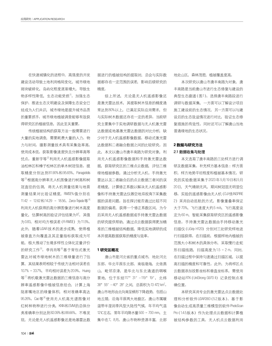
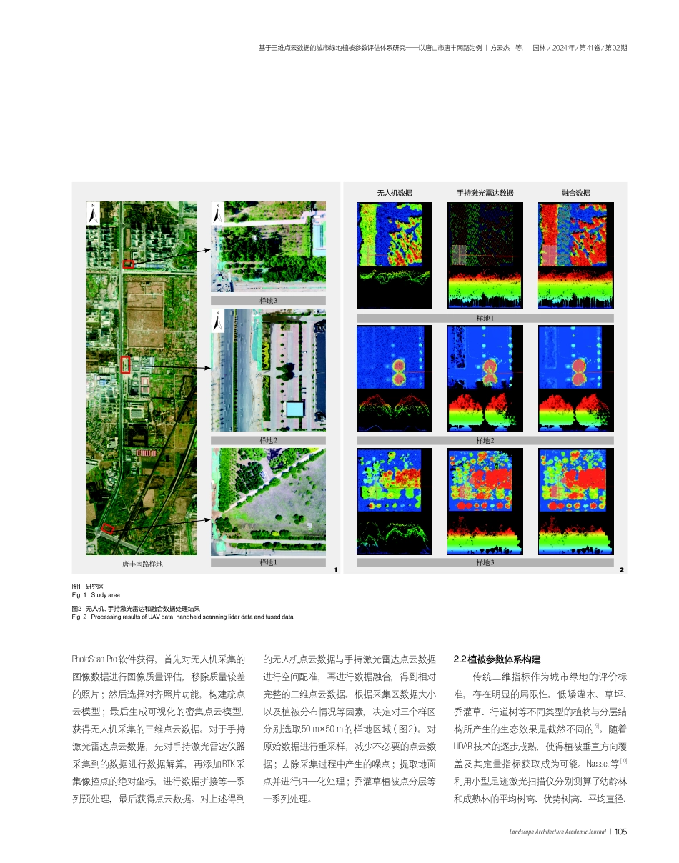
103LandscapeArchitectureAcademicJournal园林/2024年/第41卷/第02期AbstractThetraditionalmeasurementmethodofvegetationindicatorsconsumesalotofmanpower,materialresourcesandtime,andignorestheecologicalbenefitsofdifferentvegetationtypesandstructures.Thepointclouddatacaneffectivelyevaluatethe3Dvegetationparametersofurbangreenspace,butduetotheinfluenceofdataaccuracy,algorithmsoftwareandotherfactors,theaccuracyoftheresultsofthismethodhasanerrorof10%to20%.Inthispaper,takingTangfengSouthRoadinTangshanCityasanexample,threetypicalsampleplots(50m×50m)wereselectedtocollectUAVremotesensingimagesandhandheldlidardata,andathree-dimensionalvegetationparametersystemwasconstructedfromthesingletreescaleandthesampleplotscale.CorrectioncoefficientswereproposedforeightparametersintheUAVpointclouddata,includingthenumberofindividualtrees,thetotalcrownwidtharea,thegreenamountofthetreelayer,thegreenamountoftheshrublayer,theaveragethree-dimensionalgreendensity,thecanopydensity,thegaprateandtheleafarea,andthefiveparametersofthehandheldlidardata,includingtheaveragetreeheight,theaveragecrowndiameter,theaveragecrownwidtharea,thegreencontentofthearborlayerandtheaveragethree-dimensionalgreendensity,inordertoimprovetheaccuracyoftheresultsandprovidehelpforthefollow-upresearch.Final-ly,thispaperdiscussesthepossibleapplicationdirectionsofUAVphotogrammetrytechnologyandlidartechnologyinthefuture.KeywordsUnmannedAirVehicle,UAV;photogrammetry;LightDetectionandRanging,LiDAR;datafusion;three-dimensionalvegetationparameters园林,2024,41(02):103-110.文章编号:1000-0283(2024)02-0103-08DOI:10.12193/j.laing.2024.02.0103.013中图分类号:TU986文献标志码:A收稿日期:2023-11-07修回日期:2023-12-04摘要传统植被指标的测量方式需要消耗大量的人力、物力与时间,且忽视了不同植被类型和结构的生态效益影响。基于点云数据能够有效评估城市绿地三维植被参数,但受制于数据精度、算法软件等因素影响,该方法结果精度存在10%~20%的误差。以唐山市唐丰南路为例,选取了三处典型样地(50m×50m),进行无人机遥感影像和手持激光雷达数据采集,从单木...